
There is a woman resting on the slopes of Mount Everest right now. She has been there since 1998. Climbers passing her at 8,200 meters call her the Sleeping Beauty of Everest — and her story is one of the most haunting, human, and unforgettable in the entire history of high-altitude mountaineering.
But here is what most people never realize: Everest itself carries just as many extraordinary untold stories. Multiple names from different cultures. A naming history involving colonial politics and a British surveyor who actually opposed having the mountain named after him. A height that has been officially revised multiple times. And a geological origin that begins not at a mountain summit but at the bottom of an ancient sea.
This guide covers all of it — from the Sleeping Beauty story to Everest facts, Everest history, real local names, exact height measurements, and the geological forces that created the world’s highest point. By the end, you will understand Everest in a way that most people never do.
🌸 Quick Answer
Who is the Sleeping Beauty of Everest? Francys Arsentiev, an American mountaineer who died on May 24, 1998 at approximately 8,200 meters during her descent from the summit. She had successfully climbed without supplemental oxygen. Her peaceful resting appearance on the slope gave her the name. In 2007, climber Ian Woodall returned to move her body to a more dignified resting place.
Who Is the Sleeping Beauty of Everest?
Francys Arsentiev was not an amateur adventurer. She was an experienced high-altitude mountaineer with genuine skill, attempting something remarkable — summiting Everest without supplemental oxygen. This achievement would have made her the first American woman to accomplish it.
She and her husband Sergei reached the summit on May 22, 1998. During their descent, the couple became separated in deteriorating conditions. Francys collapsed from exhaustion and severe hypoxia at approximately 8,200 meters — deep inside what climbers call the Death Zone.
What makes her story particularly devastating is this: she was found alive. Twice. Two separate climbing teams — one including Ian Woodall and Cathy O’Dowd — encountered her still conscious but completely unable to move or be assisted to safety. At that altitude, a rescue is almost physically impossible. The oxygen deprivation affecting any would-be rescuer is nearly as severe as that affecting the person they are trying to save.
Francys died on the mountain. Her husband Sergei disappeared attempting to find help for her and his body was later discovered at the base of a cliff. They died separately, on the same mountain, within hours of each other.
Her peaceful resting position — eyes closed, appearing almost asleep — led subsequent climbers to give her the name Sleeping Beauty of Everest. The sleeping beauty Everest face photo that circulated online for years confronted millions of people with the reality of what the Death Zone actually means for human bodies pushed beyond their limits.
Many climbers who have passed her described the experience as profoundly affecting — a sudden, visceral reminder that beneath every summit attempt is a human being with a family, a history, and a life. As mountaineer and author Jon Krakauer has noted, the presence of bodies on Everest’s upper slopes creates a psychological weight that no training fully prepares climbers for.
In 2007, Ian Woodall returned to Everest with a specific purpose. He wrapped Francys in an American flag and moved her body away from the climbing route, giving her a more private and dignified resting place on the mountain she died attempting to descend. It was an act of humanity at one of the most inhospitable places on Earth.
For more on human resilience and the relationship between physical wellbeing and extraordinary challenges, explore our guide on hair grow faster and stronger and wellness fridges smart trend — two perspectives on how humans approach the limits of their physical potential.
What Is Mount Everest’s Real Name?
🌸 Quick Answer
Mount Everest has two primary local names: Sagarmatha in Nepali (meaning “goddess of the sky”) and Chomolungma in Tibetan (meaning “goddess mother of the world”). Both names predate the English name by centuries and remain the primary names used within their respective communities today.
Most people never realize that the name “Mount Everest” is the newest name the mountain has — and the only one given by people who had never actually lived near it.
Sagarmatha is the official Nepali name, recognized by the Government of Nepal on all official maps and documents. It derives from Sanskrit roots meaning “goddess of the sky” or “head of the sky touching heaven.” The national park surrounding the mountain on the Nepali side is named Sagarmatha National Park in its honor.
Chomolungma is the Tibetan name used by communities on the northern side of the mountain. It translates as “goddess mother of the world” — a name that reflects the deep spiritual significance the mountain carries for people who have lived in its shadow for generations. The monte Everest map used by Chinese cartographers labels it Qomolangma, the pinyin romanization of this Tibetan name.
But there is another fascinating detail most people overlook. The name Chomolungma does not refer to a single specific peak in the oldest Tibetan geographical traditions — it describes the entire massif, the broader mountain presence, rather than the single summit point. This reflects a fundamentally different cultural relationship with mountains compared to the Western tradition of naming individual peaks.
| Language | Name | Meaning |
|---|---|---|
| Nepali | Sagarmatha | Goddess of the sky |
| Tibetan | Chomolungma | Goddess mother of the world |
| Chinese | Qomolangma | Tibetan name in pinyin |
| English | Mount Everest | Named after George Everest |
| Survey | Peak XV | Original survey designation |
| Sanskrit | Deodungha | Holy mountain |
For more on how cultural identity and beauty standards connect across different traditions, explore our guide on what are korean beauty standards — a fascinating look at how different cultures define and celebrate beauty in their own terms.
How Did Mt Everest Get Its Name?
The story of how Everest got its English name involves colonial surveying, mathematical genius, political complexity — and an irony so significant that it deserves far more attention than it typically receives.
🌸 Quick Answer
Mount Everest was named after Sir George Everest, British Surveyor General of India, by his successor Andrew Waugh in 1865. The Royal Geographical Society accepted the name despite George Everest himself opposing it, arguing that local names should be used instead.
The British Great Trigonometrical Survey of India began in 1802 with the goal of mapping the subcontinent with mathematical precision. By the 1840s, surveyors had reached the Himalayan region and began measuring peaks from observation stations in the plains far below — a genuinely remarkable feat of calculation given the equipment available at the time.
A peak designated Peak XV was observed from six different stations between 1847 and 1849. The raw observations were handed to Radhanath Sikdar, an Indian mathematician working for the survey, for processing. According to survey records, Sikdar reported to Andrew Waugh in 1852 that he had found the highest mountain in the world — the first mathematical confirmation of what the mountain’s neighbors had known for centuries.
The original calculated height was 29,002 feet. The currently accepted figure is 29,031.7 feet. That 1852 calculation, made without computers, GPS, or modern surveying tools, was off by less than 30 feet. The mathematical skill involved was extraordinary.
But there is another fascinating detail in this story. Waugh claimed he could not find a consistent local name for the mountain. This claim is now widely understood by historians to be false, or at minimum a significant oversight — both Chomolungma and Sagarmatha were in active use. The failure to identify them reflects the survey’s limited engagement with local communities rather than any genuine absence of local names.
Waugh proposed naming the mountain after his predecessor Sir George Everest. The proposal was accepted by the Royal Geographical Society in 1865.
The significant irony: George Everest opposed the naming. In his objection submitted to the Royal Geographical Society, he specifically argued that his name could not be written in Hindi, could not be easily pronounced by local people, and that local geographical names should be preserved and used. He was overruled. The mountain has carried his name internationally ever since — a permanent monument to a decision its namesake actively resisted.
When did Mount Everest get its modern name? Officially 1865, approximately 13 years after Sikdar’s calculations first identified it as the world’s highest peak.
For more on names, meanings, and cultural identity, explore our guide on american beauty rose symbol which explores how symbols and names carry cultural meaning across generations.
How High Is Mount Everest? The Answer Has Changed
🌸 Quick Answer
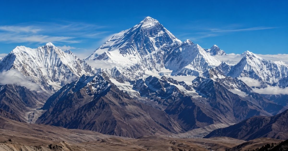
Mount Everest stands at 8,848.86 meters (29,031.7 feet) above sea level. This was established by a joint Chinese-Nepali survey in 2020. Previous measurements placed it at 8,848 meters or 29,029 feet — the figure used in textbooks from 1954 to 2020.
Most people never realize that Everest’s official height has been revised multiple times. This is not because the mountain keeps growing — though technically it does, very slowly — but because measurement technology keeps improving.
The original 1852 calculation gave 29,002 feet. A 1954 Survey of India measurement established 29,028 feet, which was rounded to 29,029 feet and became the standard figure used worldwide for six decades. A 1999 American expedition using GPS technology produced a measurement of 29,035 feet — but this figure was never officially adopted.
The 2020 joint Chinese-Nepali measurement used GPS receivers placed directly on the summit, combined with gravimetric data to account for the difference between geometric height and height above the geoid — Earth’s theoretical sea level surface. The result: 8,848.86 meters, or 29,031.7 feet. Both Nepal and China officially adopted this figure simultaneously.
Height comparison worth knowing:
| Measurement | Year | Height (meters) | Height (feet) |
|---|---|---|---|
| Original calculation | 1852 | 8,840 approx | 29,002 |
| Survey of India | 1954 | 8,848 | 29,029 |
| GPS expedition | 1999 | 8,850 | 29,035 |
| Joint survey | 2020 | 8,848.86 | 29,031.7 |
There is also a genuinely interesting philosophical question embedded in Everest’s height measurement. The mountain sits on a significant thickness of snow and ice. The 2020 survey measured to the top of the snow, not the bedrock underneath. The bedrock summit is actually approximately 3.5 meters lower than the official figure. Whether to measure to snow or rock has been a genuine point of debate among surveyors — Nepal traditionally measured to snow, China traditionally measured to rock, and the 2020 joint survey resolved the disagreement by adopting the snow measurement as the official standard.
How Was Mount Everest Formed?
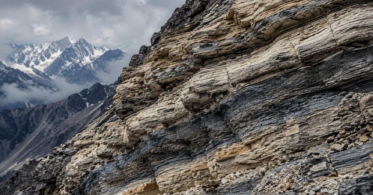
Most people never realize this: the rocks near Everest’s summit were once on the floor of an ancient ocean. The highest point on Earth began its existence as deep-sea sediment.
🌸 Quick Answer
Mount Everest formed through the collision of the Indian and Eurasian tectonic plates approximately 50 million years ago. The region was previously the floor of the ancient Tethys Sea. Marine fossils found near the summit confirm this oceanic origin. The Himalayas continue rising at approximately 5 millimeters per year.
Approximately 50 million years ago, the Indian subcontinent was drifting northward across what is now the Indian Ocean. When it collided with the Eurasian plate, the immense pressure of that collision had nowhere to go but upward. The Tethys Sea that had occupied the space between the two plates was compressed, its seafloor sediments folded and pushed skyward over millions of years to become the Himalayan range.
Geologists have found marine limestone and fossils of sea creatures in rocks collected near the Everest summit. This is not a curiosity — it is direct physical evidence of the mountain’s oceanic origin, and one of the most vivid examples of geological transformation on Earth.
The Himalayas are still rising today at approximately 5 millimeters per year. However, erosion from wind, ice, and weather removes material at a roughly similar rate, keeping the mountain’s height relatively stable on human timescales. On geological timescales, the precise height is always in flux.
Key formation facts:
- Collision began: approximately 50 million years ago
- Previous environment: floor of the Tethys Sea
- Evidence: marine fossils found near summit
- Current rise rate: approximately 5mm per year
- Rock types at summit: marine limestone and metamorphic rock
For more on natural beauty and how the natural world shapes everything around us, explore our guides on best skincare products and layer korean skincare — both deeply informed by naturally-derived ingredients and earth-based formulations.
Everest Map: Location, Routes, and Geography
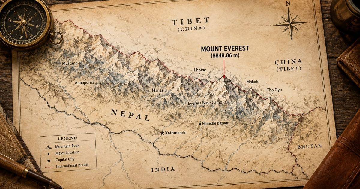
Mount Everest sits precisely on the border between Nepal and the Tibet Autonomous Region of China. The summit itself straddles both countries — technically, standing on the top of the world means standing in two nations simultaneously.
Coordinates: 27.9881° N, 86.9250° E
What mountain range is Mt Everest in? Everest sits in the Mahalangur Himal subrange of the broader Himalayan range. The Himalayas extend approximately 2,400 kilometers across six countries — India, Nepal, Bhutan, China, Pakistan, and Afghanistan. The range contains all fourteen peaks above 8,000 meters, with Everest as the highest at one end and the other thirteen distributed across the range.
Two primary climbing routes access the summit:
Southeast Ridge (Nepal route):
- Approaches through Khumbu Valley
- Passes Namche Bazaar and Tengboche Monastery
- Base Camp at 5,364 meters
- Used by approximately 75% of commercial climbers
- Includes the Khumbu Icefall — one of the most technically dangerous sections
North Ridge (Tibet route):
- Approaches through Tibet
- Different technical challenges including the Second Step
- Used by fewer commercial expeditions
- Historically the first route explored by Western climbers
Both routes enter the Death Zone above 8,000 meters — the elevation where Francys Arsentiev died and where approximately 200 other climbers remain permanently, including several visible from the standard climbing routes.
Everest Facts That Change How You See the Mountain
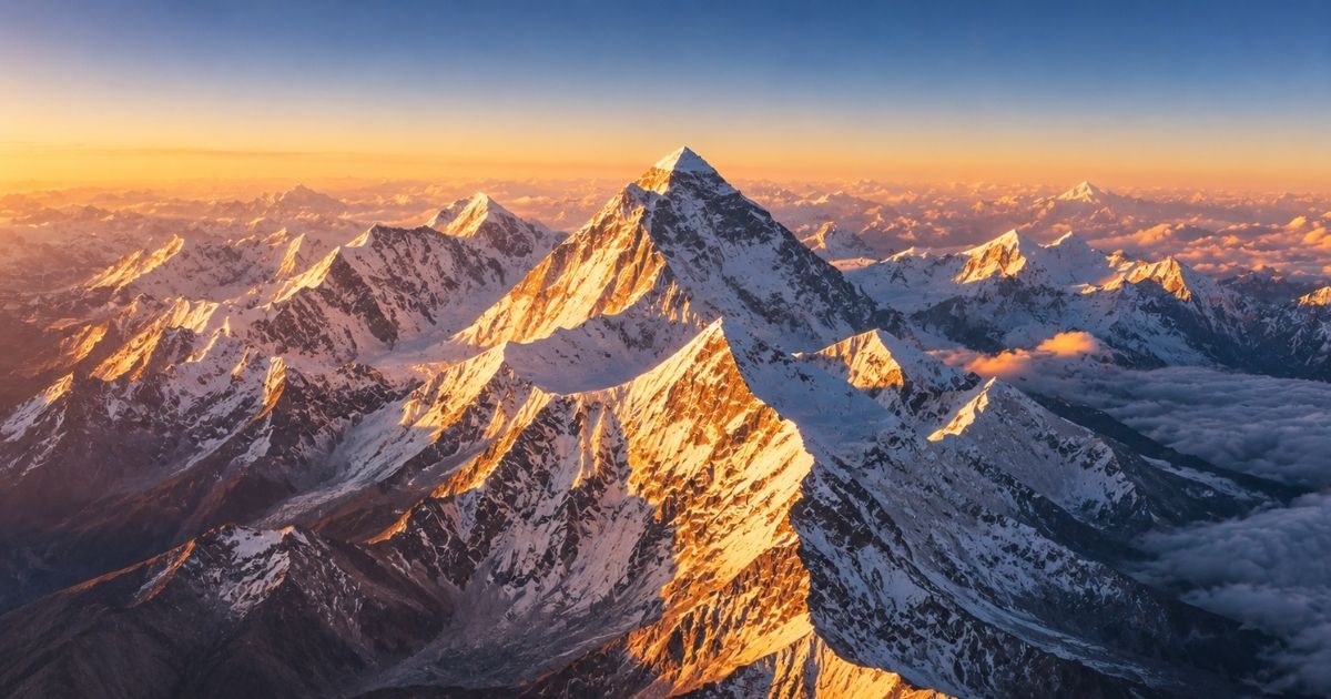
Most Everest facts focus on numbers. But the most interesting facts reveal something about the human relationship with extreme environments.
The first summit: Edmund Hillary of New Zealand and Tenzing Norgay Sherpa reached the top on May 29, 1953. The news reached London on June 2, 1953 — the morning of Queen Elizabeth II’s coronation — and was received as a moment of national triumph in Britain. Hillary later said the public reaction surprised him; he and Norgay had simply been trying to climb a mountain.
The record holder: Kami Rita Sherpa has summited Everest 29 times as of 2024. To put that in perspective — most climbers attempt Everest once, spend years preparing, and consider a single summit the achievement of a lifetime. Kami Rita has done it 29 times, often guiding other climbers to their first summit while achieving another of his own.
The Death Zone reality: Above 8,000 meters, the human body cannot acclimatize regardless of how fit or prepared a climber is. The available oxygen in each breath is approximately one third of what exists at sea level. Many climbers describe the Death Zone as the point where even lifting a foot for the next step requires conscious, deliberate mental effort. Tasks that take seconds at sea level — putting on gloves, checking a watch — can take minutes at this altitude.
The traffic problem: The commercial era of Everest climbing has created a genuinely novel problem. During the brief summit window in May when weather permits, hundreds of climbers can be attempting the summit simultaneously. The famous photographs of queuing climbers on the fixed ropes near the summit reflect a reality that the mountain’s early explorers could not have imagined. The queue problem contributes directly to deaths — climbers spend dangerous amounts of time at extreme altitude waiting for the line to move.
The yeti from Expedition Everest: Disney’s theme park attraction brought the Himalayan legend to worldwide popular attention. The actual Sherpa and Tibetan tradition of the Migoi — a powerful, dangerous creature of the high mountain regions — predates Western contact by centuries. Modern DNA analysis of alleged yeti hair samples has consistently identified Himalayan bear species rather than any unknown primate. But the cultural tradition deserves respect as genuine folklore rather than dismissed as pure fantasy.
For wellness content connecting human ambition with physical self-care, explore our guides on hair grow faster and stronger and best skincare products for a complete head-to-toe approach to physical wellbeing.
Frequently Asked Questions
What is Mount Everest called in Nepal?
In Nepal, Mount Everest is officially called Sagarmatha, meaning “goddess of the sky” in Sanskrit. This is the government-recognized name used on all official Nepali maps. Sherpa and Tibetan communities on both sides of the Nepal-Tibet border also use Chomolungma, meaning “goddess mother of the world” — a name significantly older than the English name officially assigned in 1865.
How high is Mount Everest in feet and meters?
Mount Everest stands at 8,848.86 meters or 29,031.7 feet above sea level, according to the 2020 joint Chinese-Nepali survey. This updated measurement replaced the previous figure of 8,848 meters or 29,029 feet used in textbooks since 1954. The 2020 survey used GPS receivers placed directly on the summit combined with gravimetric data for maximum precision.
Why is Mount Everest called Everest and not its local name?
Everest was named by British surveyor Andrew Waugh in 1865 after his predecessor Sir George Everest. Waugh claimed he could not find a consistent local name — a claim historians now consider false or at minimum a significant oversight. Both Chomolungma and Sagarmatha were in use. George Everest himself opposed the naming, arguing local names should be preserved. The Royal Geographical Society overruled his objection.
Who is the Sleeping Beauty of Everest and what happened?
The Sleeping Beauty of Everest is Francys Arsentiev, an American mountaineer who summited Everest on May 22, 1998 without supplemental oxygen. During descent she collapsed at 8,200 meters from exhaustion and hypoxia. Two climbing teams found her alive but unable to rescue her at that altitude. She died on the mountain. In 2007, Ian Woodall returned to Everest to move her body to a more dignified resting place, wrapped in an American flag.
When did Mount Everest get its modern English name?
Mount Everest officially received its English name in 1865 when the Royal Geographical Society accepted Andrew Waugh’s naming proposal — approximately 13 years after Indian mathematician Radhanath Sikdar first calculated it as the world’s highest peak in 1852. Local names Sagarmatha and Chomolungma had been used by Himalayan communities for centuries before this official English naming.
What mountain range is Mount Everest located in?
Mount Everest sits in the Mahalangur Himal subrange of the Himalayan mountain range. The broader Himalayas extend approximately 2,400 kilometers across six countries — Nepal, China, India, Bhutan, Pakistan, and Afghanistan. The range contains all fourteen of the world’s peaks above 8,000 meters, with Everest as the highest at 8,848.86 meters above sea level.
How was Mount Everest formed geologically?
Mount Everest formed through the collision of the Indian and Eurasian tectonic plates approximately 50 million years ago. The region was previously the floor of the ancient Tethys Sea — proven by marine fossils found in summit rocks. The collision pushed ancient seafloor upward over millions of years to create the Himalayan range. The mountains continue rising at approximately 5 millimeters per year as the Indian plate pushes northward.
Final Thoughts
Everest is not simply a tall mountain. It is a geological record of Earth’s most dramatic transformation, a cultural icon carrying three different names from three different civilizations, and a testing ground where human ambition meets its most unforgiving limits.
The Sleeping Beauty of Everest — Francys Arsentiev — captures all of this at once. She achieved something remarkable. She paid the ultimate price for it. And her story, given a more dignified ending by Ian Woodall’s return in 2007, reminds every person who hears it that mountains do not care about human achievement. They simply exist, indifferent and permanent, while humans make their choices on the slopes.
Practical takeaway for readers: If Everest inspires you toward your own physical challenges, start with understanding your body’s actual limits — not its perceived ones. The gap between the two is where most meaningful achievements happen.
For more lifestyle and wellness content, explore our complete lifestyle category and wellness fridges smart trend guide.
🌸 You Might Also Love
- Wellness Fridges Smart Trend — Nutrition and lifestyle habits for intentional healthy living
- Decorate with Books — Quiet luxury home styling ideas for every space
- Hair Grow Faster and Stronger — Complete guide to physical wellbeing and healthy hair
- Best Skincare Products — Dermatologist approved skincare for 2026
- Layer Korean Skincare — Build your complete beauty routine step by step
- American Beauty Rose Symbol — Beauty aesthetics and cultural meaning for modern women
- What Are Korean Beauty Standards — How different cultures define and celebrate beauty